

Posts with tag 'La Pine'
Subscribe and receive email notifications of new blog posts.
 RSS Feed
13
Bend Premier Real Estate | June 2024 Newsletter
What's in the June 2024 Bend Premier Newsletter?
- What are the Puzzling Trends for Bend Home Sales?
- Raspberry and White Chocolate Muffins
- 10 Ways to Prepare Your Home for Summer
- The Road to Paulina Peak in Newberry Crater is Open for Hikers
- The Wealth Building Power of Home Ownership
5
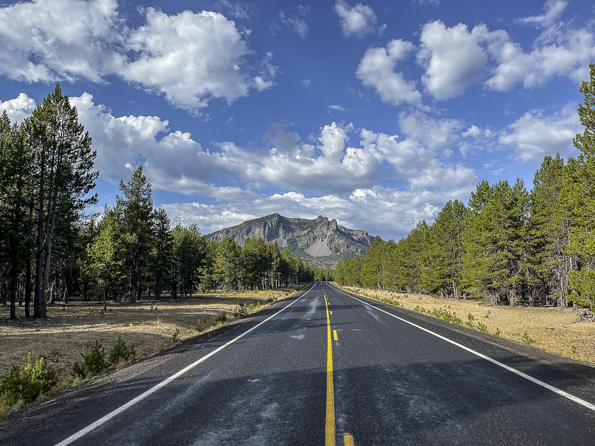
The Road to Paulina Peak in Newberry Crater is Open for Hikers Spring 2024
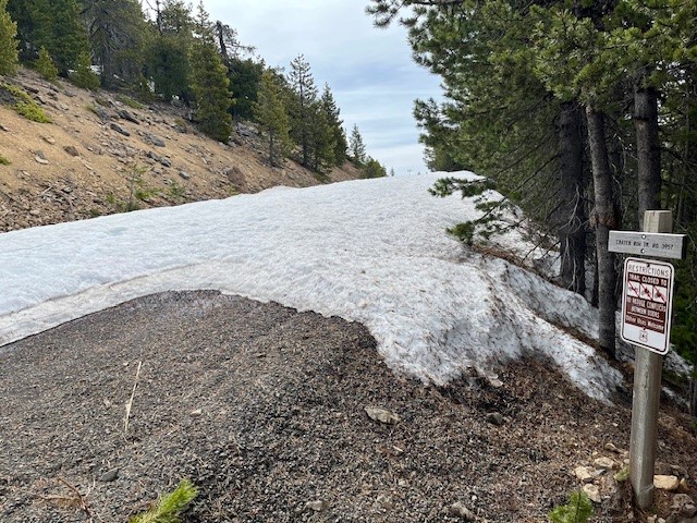
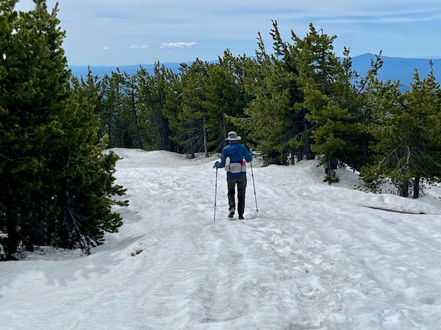
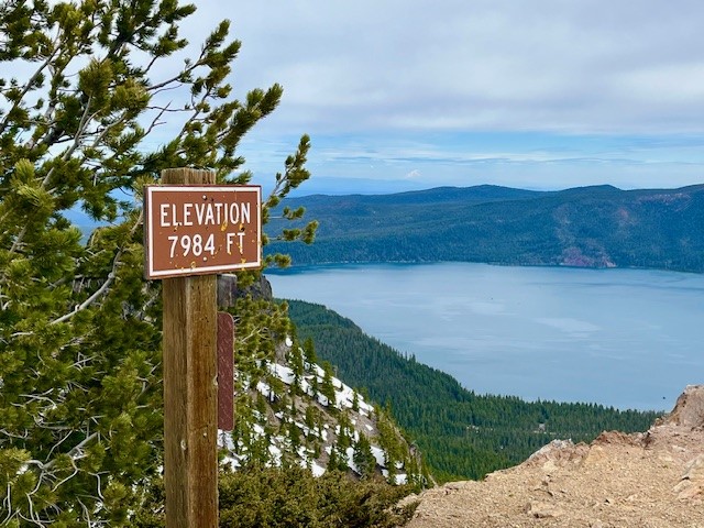
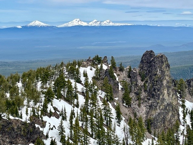
The Paulina Peak Road Has Snow But it is Melting Fast
Reports about the trail to the top of Paulina Peak in Newberry Crater National Monument on June 1, 2024 stated that the last mile had a lot of snow. Rather than navigate through this and the abrupt steep drop off the last mile of the trail, hikers could elect to walk the road up to the peak. This road was not yet open for vehicles and had snow patches in the shady areas, but was very much passable by hikers. The last 1/2 mile to the peak on the road had three feet of compacted snow, but with the use of trekking poles, it was easily traversed. The views of the snow capped Cascades and Paulina Lake were splendid from the top as were eastern views toward Fort Rock and the Obsidian Flow. Hiking the road results in 1600 feet of elevation gain to the peak which is just under 8000 feet above sea level, but over a more gradual grade than the trail, making for a longer hike but more easily done. All in all, the total hike by the road is just under 8 miles up and back from the gate off the main road through the monument.
 |
 |
 |
 |
3
Central Oregon Real Estate Market Trends 1st Quarter 2024
Central Oregon Market Trends 1st Quarter 2024
The Central Oregon real estate market trends for the major urban areas continue to reflect a seller's market, although residential inventory levels have risen in most locations. The desperate lack of inventory experienced during Covid has changed, and while home prices overall continue to rise, in some smaller markets price reductions can be noted. With more inventory, days on market have also generally gone up, but well priced homes are still selling quickly and multiple offers can happen. Bend, Redmond and Sunriver are showing strong upward trends in all categories with home prices, listings, inventory levels and days on market all rising. Whether or not this trend continues in 2nd quarter with mortgage interest rates well about 7% remains to be seen.
15
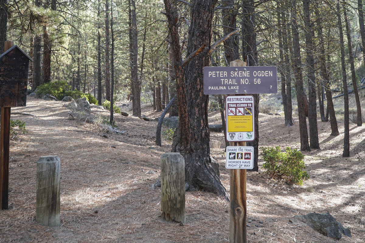
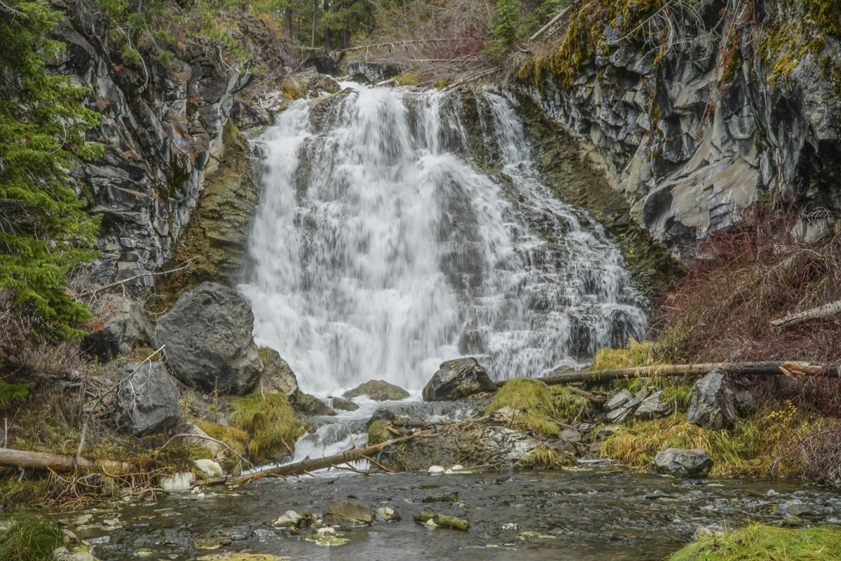
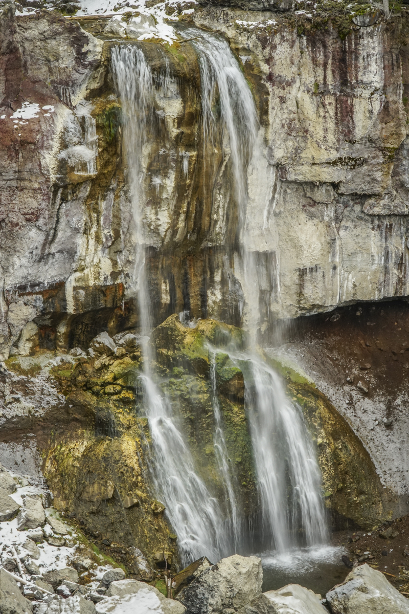
Hike to Paulina Falls at Newberry Crater Fall 2023
Peter Skene Ogden Trail is a Favorite Off Season Hike
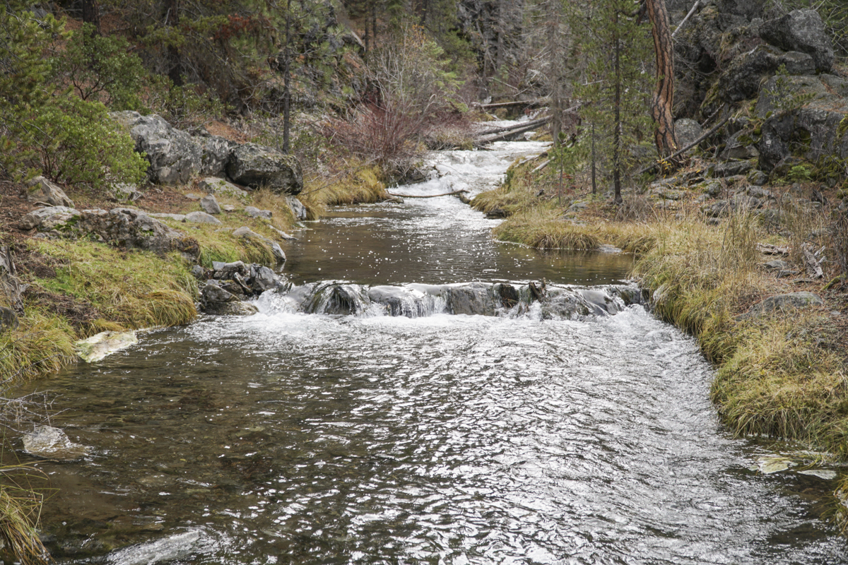
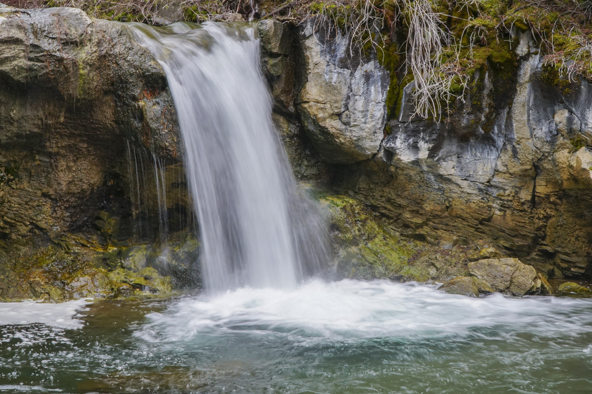
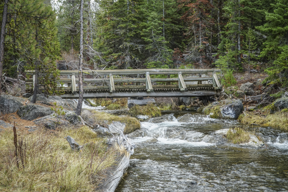
We have hiked from McCay Crossing to Paulina Falls multiple times, typically in the late fall and early spring when crowds are gone and snow accumulation is limited. We have always enjoyed the experience and have seen Paulina Creek and the numerous falls along the path in various stages of flow - spring run off, fall with lessened volume, and winter ice. Some of our favorite experiences have involved the ice, and we have named that experience "chasing frozen waterfalls."
The hike we did 11-11-23 was in the fall after first snow, but after warmer temperatures had melted much of the snow in the lower elevations. We saw just a handful of people the entire day and our hike up and back was much faster than we experience when we have to walk through snow. But we had an opportunity to discover little seen or accessed waterfalls and had a wonderful day. The total hike was 13.8 miles with roughly 1600 feet of elevation gain.
 |
 |
 |
 |
 |
|
29
Crater Rim Trail at Newberry National Volcanic Monument Worth the Trip
Crater Rim Trail Lightly Traveled
Newberry Crater, including Paulina Peak and Paulina Falls, are often our go-to hikes when the weather doesn't cooperate in exploring the Cascades. At a lower elevation, we can often hike this area well into early winter when snow stops our adventures in the higher mountain regions. And its location, between Bend and La Pine, is an easy drive from home.
Last Saturday, we ventured into Newberry Crater to avoid the choking smoke much of Central Oregon has been experiencing from the Bedrock fire and now Lookout and Petes Lake fires as well. We were fortunate that the air stayed relatively clear during our day there and we could enjoy a great hike.
 We found a hike we had never done before last Saturday. All Trails named it "Lost Lake to Crater Rim Trail" and it was a loop. The suggestion was to park at the Obsidian Flow parking lot, but we drove further down the road to an access point off the main road about a mile past.
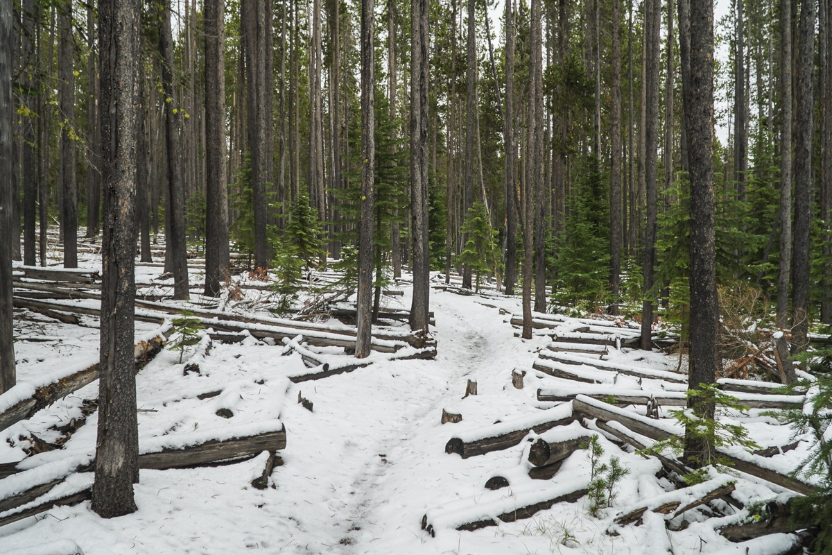
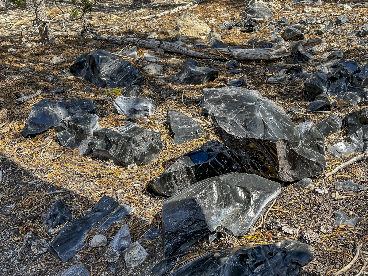
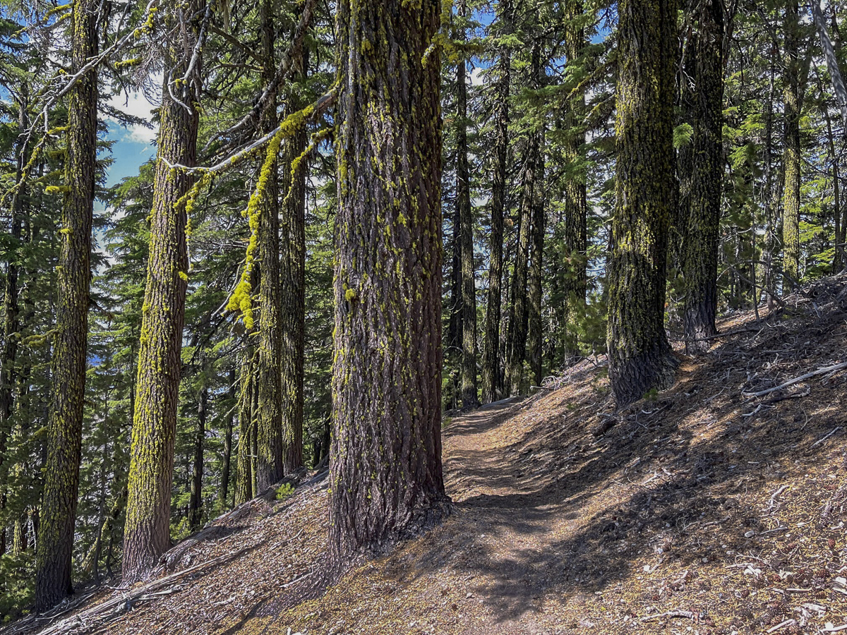
Our initial hike was through a lodgepole pine forest, but as we got further away from the road, we began to gain elevation and the trail got closer to the obsidian flow. We saw larger obsidian stones on each side of the trail as the hike got gradually steeper.
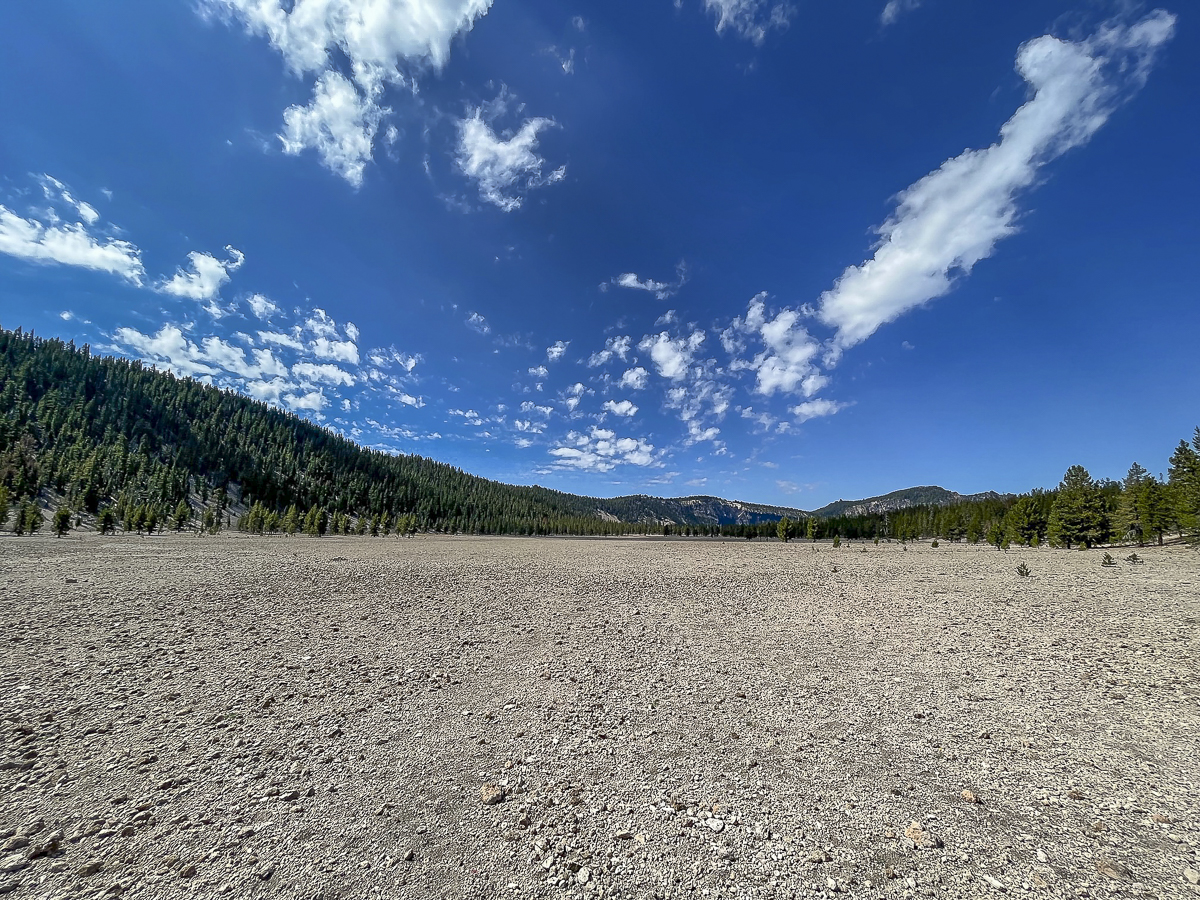
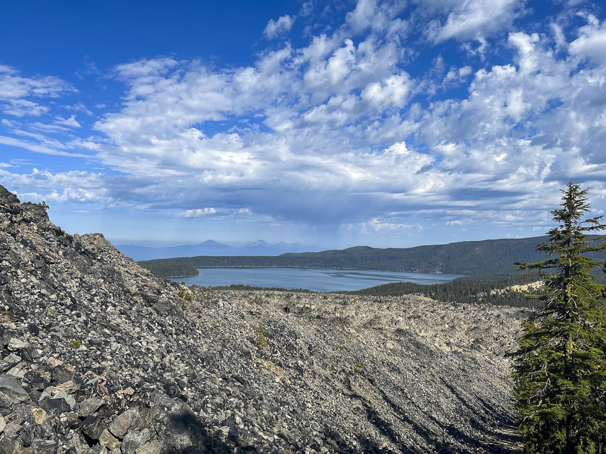
Eventually we reached the Crater Rim Trail. This trail circles Newberry Crater fully and is over 20 miles in length. We didn't want to take this hike today, but rather followed the route we downloaded. This involved a section of Crater Rim, and then a loop which dropped into a canyon that came up by Pumice Flat and rejoined our original trail. This seemed a bit short for us, so we went back up the loop and then hiked toward Paulina Peak, not fully reaching it but found a terrific lunch spot to enjoy the views of Paulina Lake. We then returned back the way we came. The entire hike was just over 13 miles with 2350 feet of elevation gain. We only saw 4 people during the entire hike - all of them riding mountain bikes.
 |
 |
 |
 |
Privacy Policy / DMCA Notice / ADA Accessibility